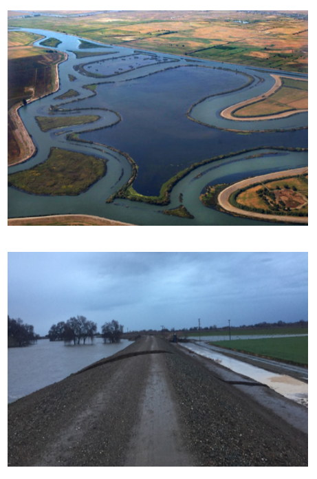
Top Photo: The San Joaquin Delta, lined with levees.
Image Courtesy of St. Mary's College of California.
Bottom Photo: Levee Breach along the San Joaquin River.
The breach resulted in the evacuation of 500 people in Manteca.
Image courtesy of the San Joaquin County Office of Emergency Services
FLOOD PROTECTION INFORMATION
Flooding in San Joaquin County
Flooding is the most common natural disaster in the United States, affecting all 50 states. Flooding typically occurs when there is a failure of water control structure, such as a levee, or when water due to rain and/or snowmelt accumulates faster than it can be absorbed or carried away by a river. San Joaquin County faces flooding risk from both of these causes.
In the early 1900s, many natural wetlands in the San Joaquin Valley were drained for agricultural use. A system of levees was introduced to prevent water from flooding the natural wetlands, which are still monitored and maintained by reclamation districts today. These districts have elected officials who patrol the levees to ensure their safety and upkeep.
In the San Joaquin Valley, there are four major rivers (the Stanislaus River, Tuolumne River, Merced River, and Mokelumne River) as well as smaller tributaries, that flow into the San Joaquin River. Melting snowpack from the Sierra Nevada as well as rainwater is carried through these rivers until they drain into the San Joaquin Delta. In a normal year, reservoirs hold the water until it can be released in a controlled manner downstream, but high precipitation can fill the reservoirs. Even on clear days, solar radiation can melt the snowpack, potentially overwhelming the reservoirs.
San Joaquin County is dedicated to reducing flooding risks and participates in the National Flood Insurance Program (NFIP) Community Rating System (CRS). This program rewards communities that take steps that go beyond minimum NFIP floodplain management requirements to reduce the risk from flooding. The County has a CRS classification of 7 which means that County residents with properties in areas with a high level of flood risk receive a 15% discount on their flood insurance premiums each year. A 5% discount applies in lower risk areas. The County encourages you to learn more about the NFIP, be aware of local risks, and be prepared to protect yourself and your property in the event of a flood, using the following resources.
The Federal Emergency Management Agency (FEMA) assesses flood risk using mapping and elevation data, among other data, to categorize floodplains according to their likelihood of flooding. The areas deemed at-risk are mapped as Special Flood Hazard Areas (SFHAs). These areas require flood insurance if they are secured by a federally backed mortgage due to their elevated risk. Always check with County Planning and Public Works departments before you build, fill, alter, or grade on your property; in addition to regular building permits, special regulations apply to construction in flood prone areas.
Be aware: SFHAs can and do change, largely due to development in an area. Impervious surfaces such as parking lots change draining patterns and can increase risk of flooding in some areas.
Find your FEMA flood zone and other locally determined flood hazard areas: Interactive Flood Zone Viewer
FEMA’s Flood Insurance Rate Maps (FIRMs), which map SFHAs, are also available through FEMA’s website at https://msc.fema.gov/. Paper copies of FIRMs, along with other flood awareness publications, are available for review at:
Cesar Chavez Central Library, 605 North El Dorado Street, Stockton, California
County Department of Public Works, 1810 East Hazelton Avenue, Stockton, California
It doesn’t end with the FEMA flood zones. Other critical habitat and areas of risk are featured in the following map resources:
Areas mapped in the National Wetlands Inventory
Areas mapped as critical habitat by the U.S. Fish and Wildlife Service
FEMA Elevation Certificates are used to accurately rate flood insurance policies. Elevation certificates for structures built or substantially improved in SFHAs since 1992 are available to the public at the Elevation Certificates Map web-page.
In the event of a flood it is important to protect yourself and your loved ones. Avoid walking or driving through flood water; just six inches of moving water can knock down an adult, and a car can be swept away in as little as one foot of water. Have an emergency kit prepared. This should include a battery or crank powered AM/FM radio, a flashlight, a first aid kit, water (one gallon per person per day), and copies of important family documents such as prescriptions, proof of address, and passports. For a complete list, visit the Ready.gov website.
Pay attention to emergency alerts, TV, or radio for weather updates, emergency instructions, and evacuation orders. Flood warnings are disseminated by the Emergency Alert System through local radio and television stations and by NOAA Weather radio at 162.55 MHz. Follow the San Joaquin Office of Emergency Services on Twitter, Facebook, and Youtube for up-to-date local emergency information. You can also check out the county flood ALERT site to for forecasts, gage maps, and flood guidance.
After a flood, avoid contact with floodwater, which may contain contaminants. If there are power lines down around your home, report them immediately to the electrical company and do not step in puddles or standing water. If any gas or electrical appliances were flooded, don’t use them until they have been checked for safety.
Find your evacuation route: http://www.sjmap.org/evacmaps/
Find a shelter: https://www.sjgov.org/department/oes/care-shelter
Damage from just one inch of water can cost more than $20,000. The most reliable way to protect your property from flood damage is to build outside of a flood hazard area. If you are located in a flood hazard area, you can minimize likelihood of damage through low cost measures including:
Raise your furnace, water heater, and electric panel to higher floors or the attic if they are in areas of your home that may be flooded.
Install check valves in plumbing to prevent floodwater from backing up into the drains of your home.
Seal walls in basements with waterproofing compounds to avoid seepage through cracks.
Move furniture and any other valuables to higher floors.
Keep materials like sandbags, plywood, plastic sheeting and lumber handy for emergency waterproofing.
Clearing brush and debris away from storm drains and ditches so water can drain away from the structure.
Upon request, San Joaquin County Public Works staff are available for site visits to review flood, drainage, and sewer issues and provide information on mitigation and retrofitting options. They can also answer site-specific questions about historic flooding and flood insurance claims. Questions and requests can be directed through GORequest.
If your home or business is in or located near a flood hazard area, you should have flood insurance. You can purchase flood insurance even if you are not located in a FEMA SFHA. Remember: homeowner’s insurance does not cover flood damage.
If you are considering building in a Special Flood Hazard Area, consult the following resources:
SFHA Construction Booklet
Elevation Certificate and Instructions
Learn more about the National Flood Insurance Program (NFIP): https://www.fema.gov/national-flood-insurance-program
Important Links
For more information on services available through the County including elevation certificates, constructing in a flood zone, and site visits, use San Joaquin County GORequest online, to submit your request. This service is accessible 24 hours a day: https://www.sjgov.org/gorequest/request
Questions regarding flood management, including Flood Protection Information, the NFIP, and CRS, can be directed to Staff at (209) 468-9596
A list of contacts and available resources regarding flood safety and protection is located HERE
Monitor current flood conditions: https://www.sjgov.org/department/oes/current-conditions
Monitor river flood forecast: http://www.cnrfc.noaa.gov/
Learn more about flood preparedness: https://www.ready.gov/floods
Learn more about flood insurance at https://www.floodsmart.gov/
Learn more about FEMA flood mapping: https://www.fema.gov/national-flood-insurance-program-flood-hazard-mapping
Learn more about flooding in California: http://cdec.water.ca.gov/
Brochures
-
Why Do I Need Flood Insurance3.5 MB • pdf • January 31, 2023
-
Floodplain Mapping Services356 KB • pdf • October 26, 2022
-
Nothing Can Dampen the Joy of Home Ownership485 KB • pdf • November 30, 2021
-
Information on Flood Plains3 MB • pdf • November 30, 2021
-
Answers to Questions About the NFIP294 KB • pdf • November 30, 2021
-
Flood Preparation and Safety286 KB • pdf • November 30, 2021
-
Flood Emergency Preparedness191 KB • pdf • November 30, 2021
-
SJC Guide to Flood Awareness73 KB • pdf • November 30, 2021
-
SJC Guide to Channel and Levee Maintenance412 KB • pdf • November 30, 2021
